Maps Page on Country/Region
Maps of Japan
- Physical Environment
- First map name
- Second map name
- Third map name
- Weather & Climate
- First map name
- Second map name
- Third map name
- Human Environment
- First map name
- Second map name
- Third map name
- Road maps
- First map name
- Second map name
- Third map name
- City Maps
- First map name
- Second map name
- Third map name
- Urban Transportation Maps
- First map name
- Second map name
- Third map name
- Tourist Maps
- First map name
- Second map name
- Third map name
1
Physical Environment
Insert three maps here with
descriptions.
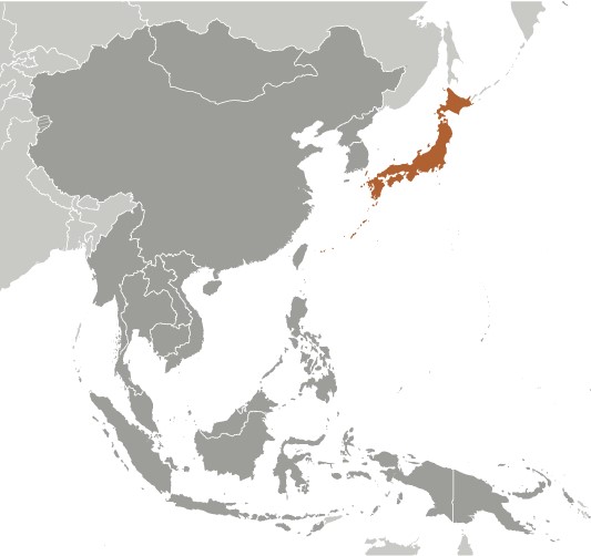
My first map shows Japan as a different color to the rest of the Asian countries around it. I got this picture from https://www.cia.gov/library/publications/the-world-factbook/geos/ja.html.� I like this picture because it helps one easily see where Japan is located in Asia.
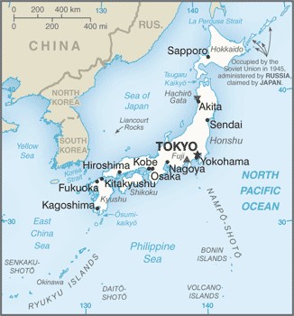
I also got this map from https://www.cia.gov/library/publications/the-world-factbook/geos/ja.html. This is a very basic yet effective general reference map. Major cities, bodies of water, and neighboring countries are all labeled and easy to see. The capital of Japan, Tokyo, is labeled with a star.
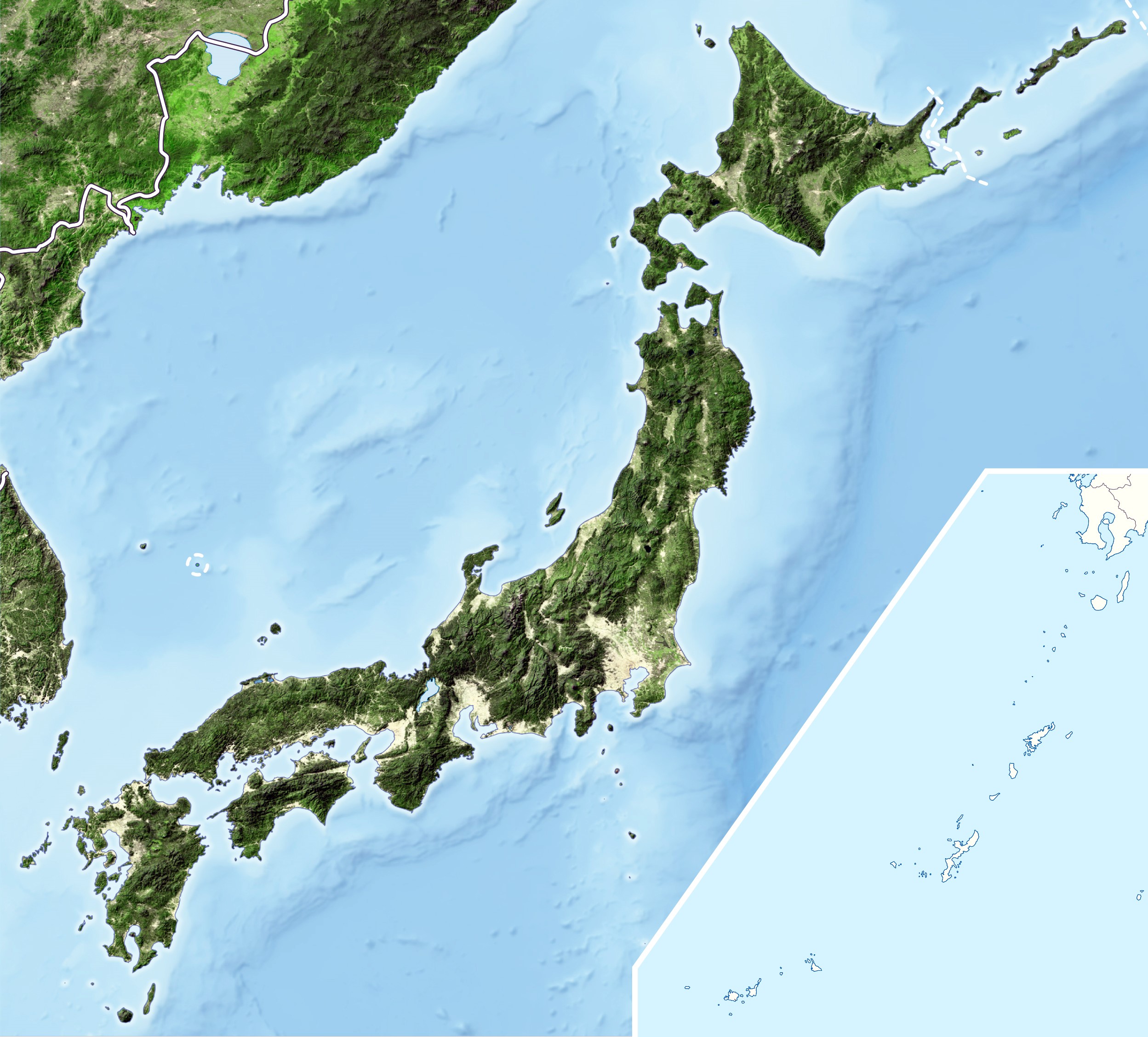
This is a relief map of Japan that I got from http://www.maps-of-the-world.net/maps/maps-of-asia/maps-of-japan/large-detailed-relief-map-of-japan.jpg.
This map does a good job of showing Japan�s geographic landscape. The mountainous
areas are clearly shown through the shadowing on the image.
2
Weather & Climate
Insert maps here with descriptions.
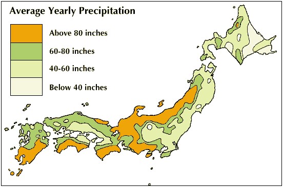
This is a map of Japan from https://kids.britannica.com/students/assembly/view/53617.
It shows the average yearly precipitation throughout Japan. The table in the corner
of the map shows what each of the colors represent.
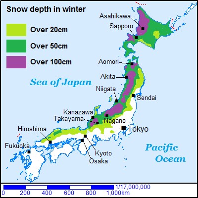
This map was found on http://travel-around-japan.com/blog/snow-covered-area-in-japan/. This map shows snow depths throughout Japan, and is easy to understand with the helpful table in the corner to explain the colors. This map has major cities and the Pacific Ocean labeled as well. I was very interested in this map and the website I found it on because I plan on staying in the northern regions of Japan, and they are known for receiving large amounts of snow throughout the winter months.
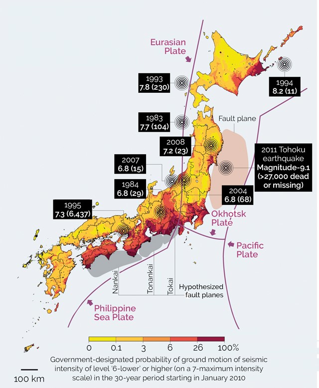
Because of Japan being a country that has a lot of seismic
activity, I thought this would be a very relevant map to add to my trip
research. This map was found on https://english.kyodonews.net/news/2018/06/a6d1d0cccb58-powerful-quakes-more-likely-to-hit-hokkaido-pacific-coast.html?phrase=ufj&words=.
This map shows which areas of Japan have the highest probability for seismic
activity, and the colors are explained at the bottom of the image. The image
goes into even more detail by listing past major earthquakes and showing where
the major plates are as well.
3
Human Environment
Insert three maps here with
descriptions of population, population density, income, etc.
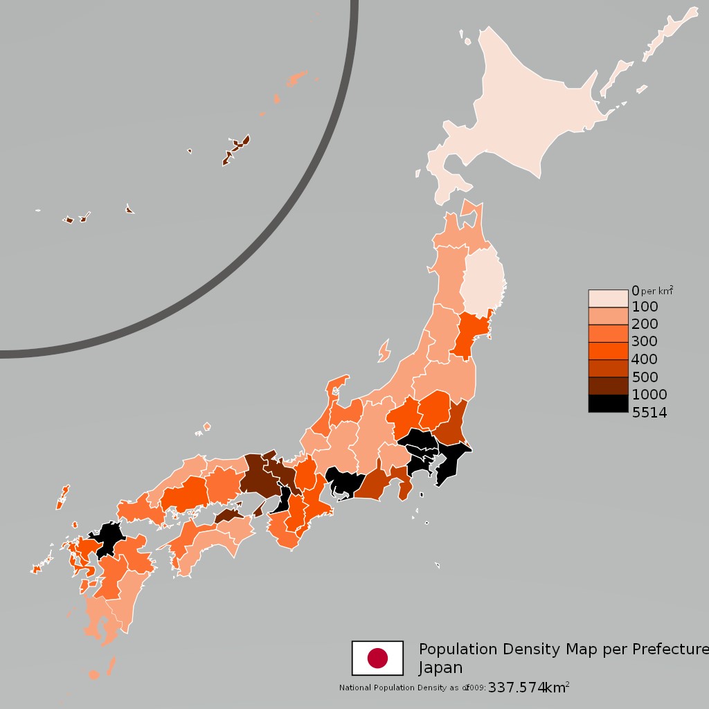
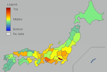
This map of Japan shows the
population density per prefecture in Japan. It goes by square kilometer and the
colors are explained in the table of he map. The darker
the color, the more dense the population is.
I found this website on an
interesting website called https://stats-japan.com/t/kiji/10714.
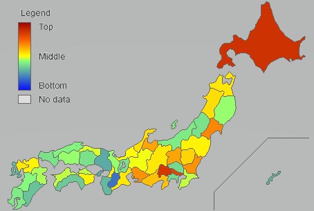
This map prefectural incomes throughout Japan. Areas with red, orange and
yellow colors rank higher than areas that are green or blue. No surprise here,
Tokyo Prefecture is the darkest shade of red on the map. The only downside to
this map was that there isn�t a description of what the map or its colors
represent on this image. On the website itself though, it not only explains the
map and colors, but you can also move your cursor to each specific prefecture
and see the score it received.
This is
another map from the same Japanese statistical website, https://stats-japan.com/t/kiji/10328.
Instead of prefectural income ranking though, this map ranks which prefectures
have the most convenient stores. It may seem silly, but convenience stores are
a cheap and easy way to get food while staying in Japan. I originally assumed
that Tokyo�s prefecture would have the most, but surprisingly Hokkaido does. To
be fair, Hokkaido is a bit bigger, I was still surprised none the less.
4
Road Maps
Insert three maps here with
descriptions.
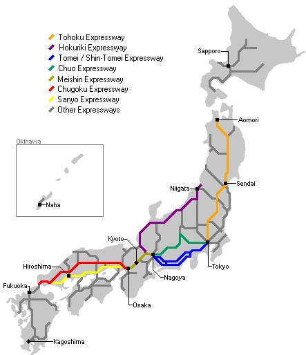
I found this map on https://www.japan-guide.com/e/e2354.html. This map shows the major expressways all throughout Japan. This map also labels major cities in Japan. I like this map because it also shows Aomori and Sapporo on this map, which are two cities that I intend to visit on this trip. Its nice to see what expressways connect to which cities.
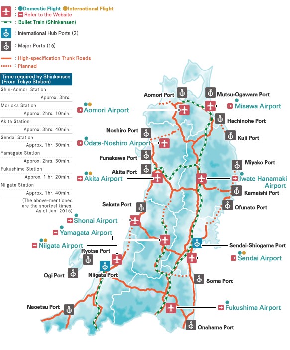
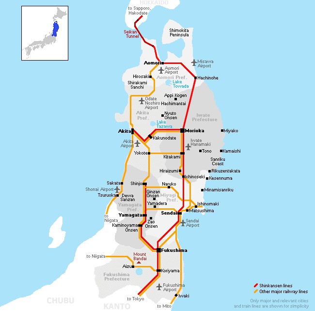
This is a map of the Tohoku region of Japan that I found on http://www.tohoku-epco.co.jp/investment/overview/infra.html. This is a helpful map that shows major roads, railways, ports, and airports. It is easy to read with a helpful table to explain the symbols on the map.
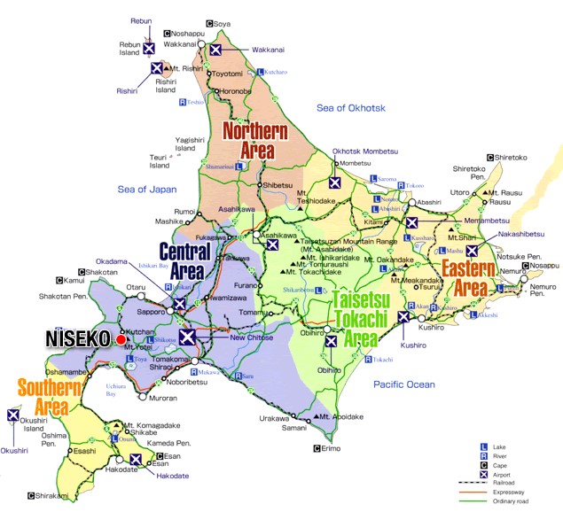
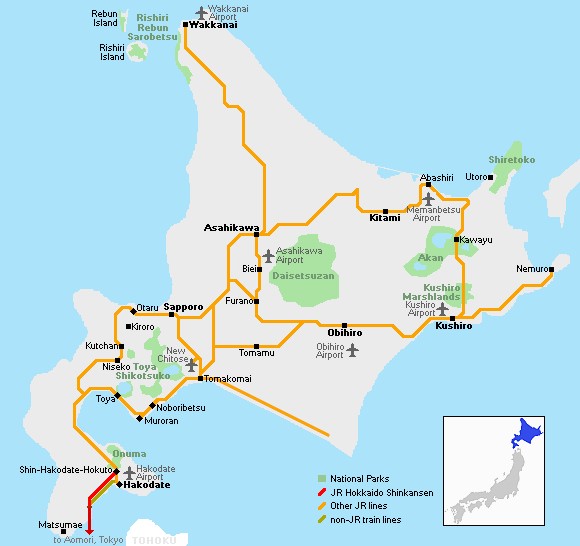
This map shows the Hokkaido region of Japan. As the Tohoku map above, this map shows major expressways and railways as well. This map which I found on http://jimmyd133.blogspot.com/2006/10/map-of-hokkaido.html, has clear text and a explains what symbols mean in the corner.
5
City Maps
Insert three maps here with
descriptions.
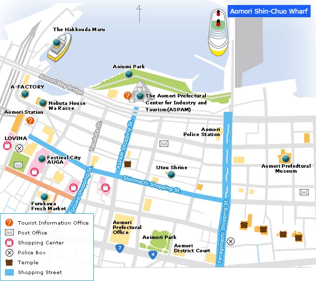
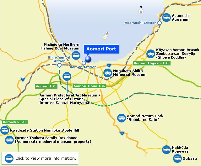
This is a simplified map of Aomori
that I found on http://www.apic-aomori.jp/english/port/spot.html.
All maps I found of Aomori that had more detail were very hard to read. This
map labels main shopping streets, shopping centers, police boxes, post offices,
temples, and tourist information areas.
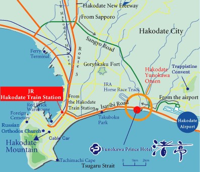
This is a city map of Hakodate, I
found this map on http://nagisatei.info/english_new/mapEn.html.
This map shows the city of Hakodate and does well to label major roadways an railways. There are areas like Mt. Hakodate, the airports,
train stations and lodging that are labeled as well.
�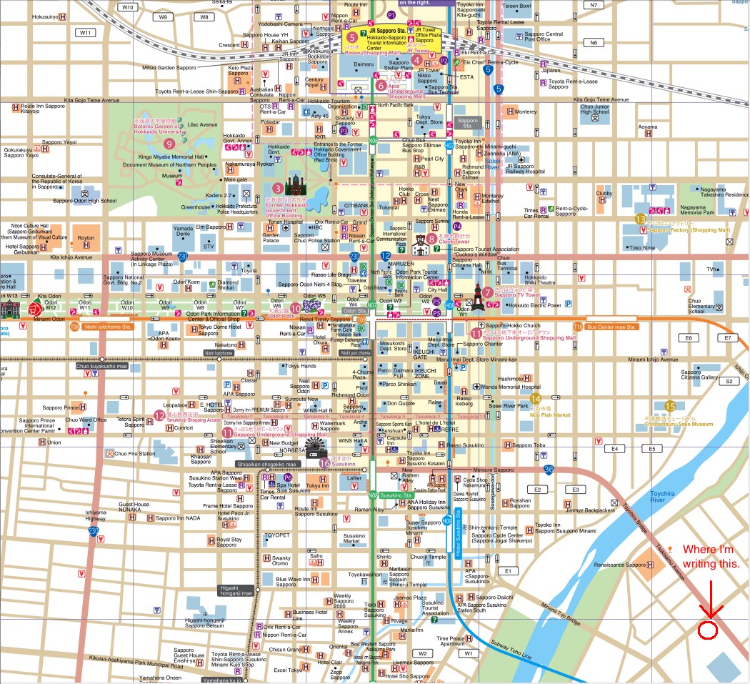
I found this detailed map on http://www.lahistoriaconmapas.com/atlas/country-map154/sapporo-city-walking-map.htm.
This map shows roads, rivers, attractions, and much more. �
6
Urban Transportation
Insert three maps here with
descriptions (bus, subway)
I found this map on http://www.apic-aomori.jp/english/port/spot_in_city.html.
This is a map of the city of Aomori, and it labels roadways, railways and tourist
sites as well.
This was a map I found on https://www.japan-guide.com/list/e1102.html.
I found this map helpful because it shows major railways throughout the Tohoku region
and even shows which connect to Hokkaido. I also like how it shows where Tohoku
is compared to the entirety of Japan.
This map is from https://www.japan-guide.com/list/e1101.html.
I appreciate the train maps because railways will be my main mode of
transportation. This map clearly shows where railways go, and like the Tohoku
map above, one can see where Hokkaido is compared to the rest of Japan. �
�
7 Tourist Sites
Insert three maps here with
descriptions.
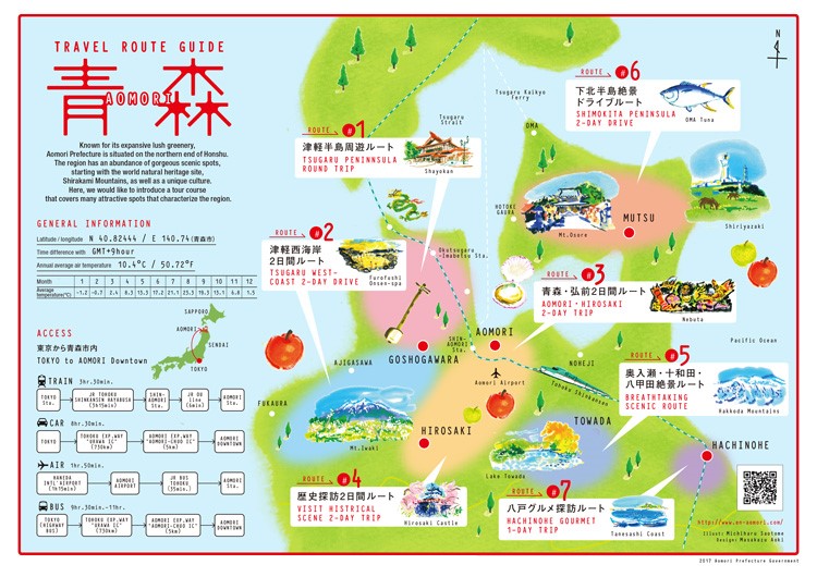
While this map may seem cartoonish,
I think it�s a fun tourist map that shows major attractions in the Aomori
prefecture. This map also shows the different routes that one can take from Tokyo
to Aomori and how long they would take. I found this map on https://www.en-aomori.com/suggested_itineraries/route05.html.
�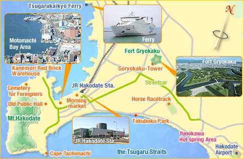
This is another simply yet effective
tourist map, this time of the city of Hakodate on Hokkaido. This map which I
found on http://www.hakonavi.com/stay2/hakodate/index.html,
does well to show major attractions in the city. The map has pictures of some
of the attractions as well.
�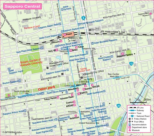
This tourist map displays the
central area of Sapporo. It�s a bit easier to read than the city map I found of
Sapporo earlier. It has a table that explains what all of
the symbols represent, even the smallest letters are easy to read, and this map
also labels fun areas for tourists to visit as well. I found this map on http://travelquaz.com/map-of-sapporo-tourist.html.
Submitted by Davis Clouse on March 1, 2019.